


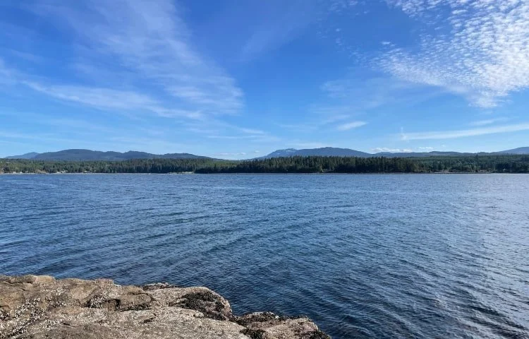

Madrona Point, Nanoose Bay
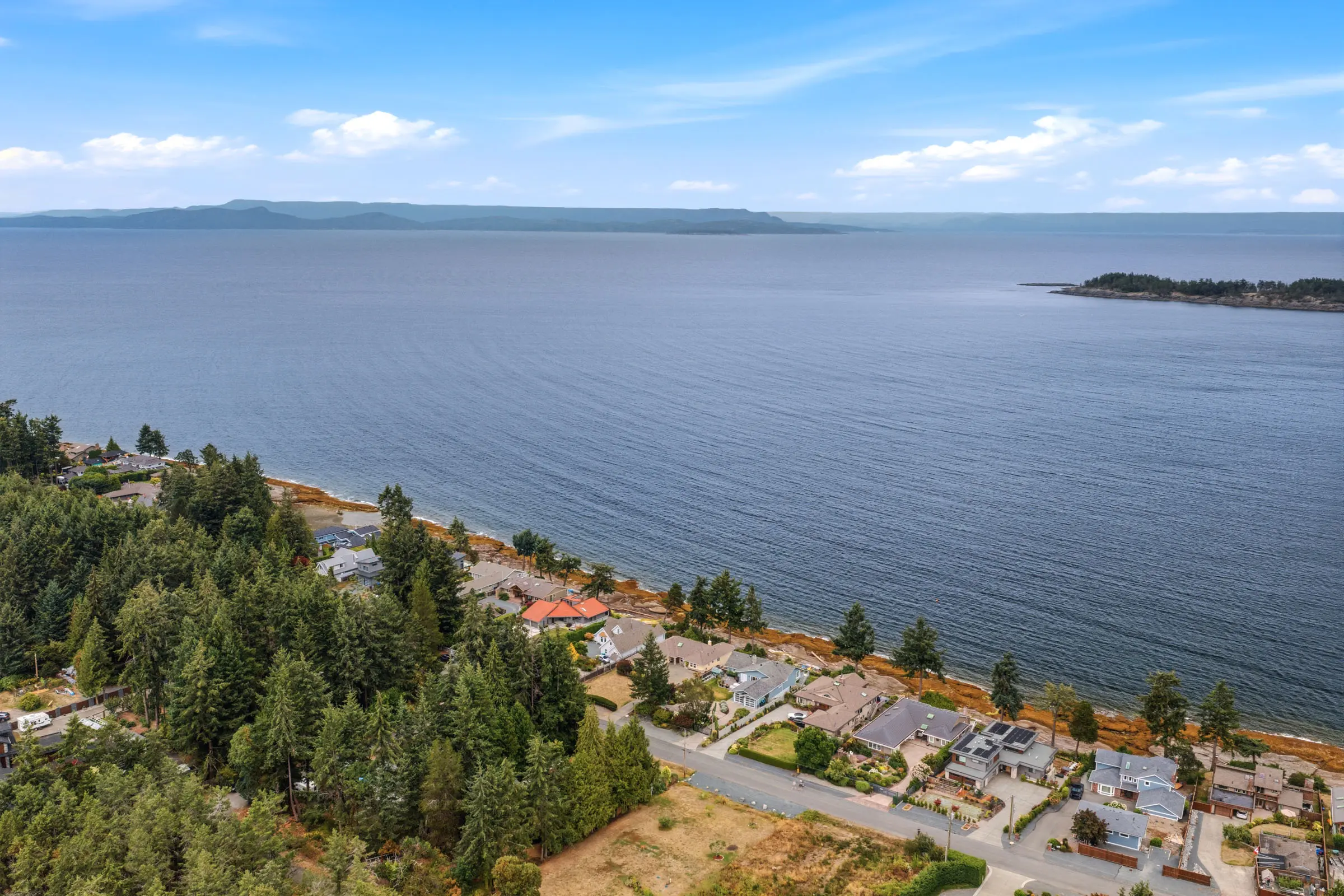
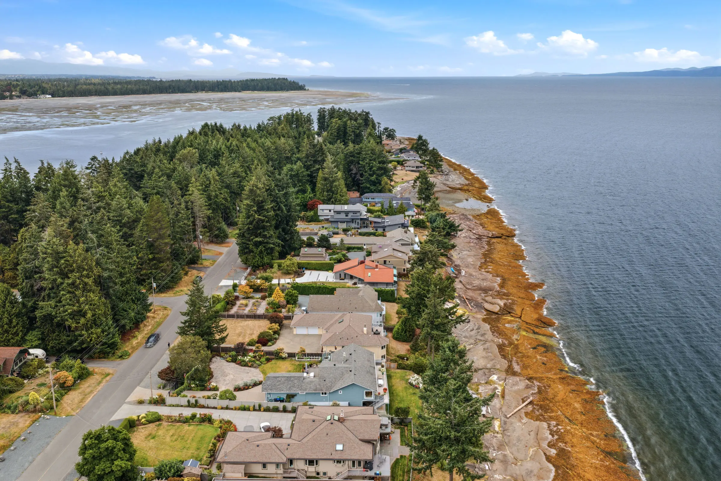
Madrona Point is a rocky peninsula at the end of Madrona Drive in Nanoose Bay, British Columbia, on the east coast of Vancouver Island within the Regional District of Nanaimo. It is one of the best-known shore diving locations on Vancouver Island, with underwater rock walls that begin close to the entry point and drop away quickly. Above the waterline it is a residential shoreline of arbutus, Douglas fir and exposed rock, with tide pools at low water.
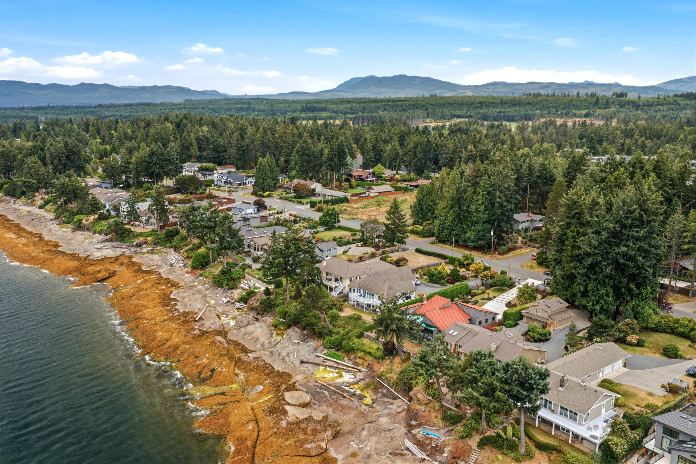
Homes along Madrona Drive are among the most sought-after in Nanoose Bay, with ocean views across the Strait of Georgia toward the Ballenas Islands. Contact the Carey Real Estate Group to talk about buying on Madrona Drive.


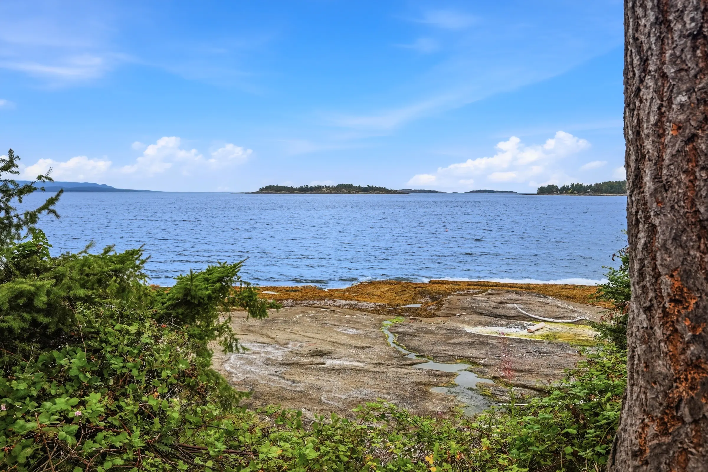
Madrona Point Highlights
-
01Four named wall dives, from roughly 60 feet to 90 feet.
-
02Giant Pacific octopus, wolf eels, lingcod and rockfish year-round.
-
03Tide pools at low water along the rock shelf.
-
04Ocean-view and waterfront homes on Madrona Drive.
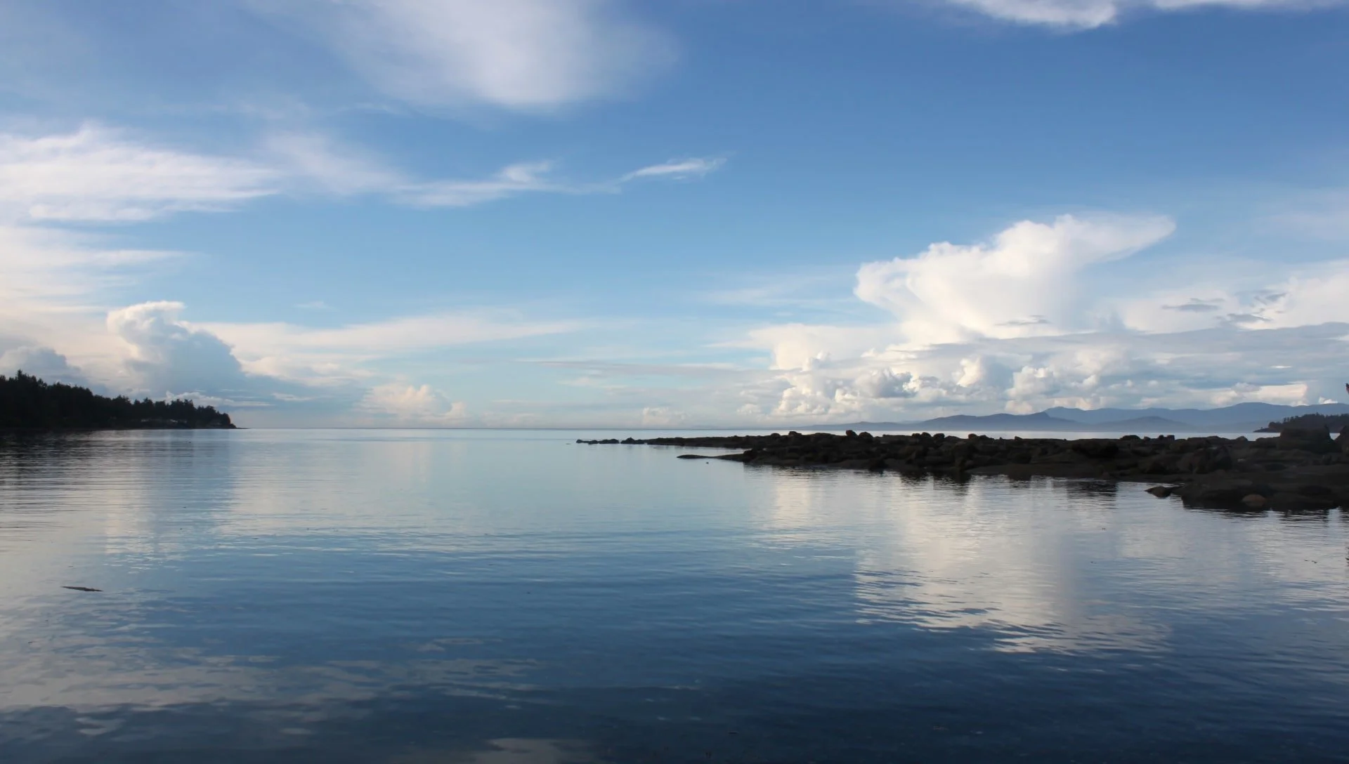
Why Divers Come To Madrona Point
Madrona Point works as a shore dive because the drop-off starts close in. Divers do not have to swim far before the bottom falls away into vertical rock, which is unusual on this coast and is the reason the site turns up on nearly every Vancouver Island dive list. There are four named dives along the point: Small Wall, Mid Wall and the Maze all bottom out around 60 feet, while Main Wall runs to roughly 90 feet and is generally treated as an advanced dive.
Visibility is best in the colder months, when plankton blooms fade and the water clears. Summer diving is warmer but hazier. The walls hold giant Pacific octopus in the deeper cracks, wolf eels in established dens, lingcod and quillback rockfish over the structure, and boot sponges, swimming scallops and nudibranchs across the rock faces. Sea lions move through the wider Nanoose Bay area in the colder months.
Madrona Drive Real Estate
Madrona Drive runs out along the peninsula to the point itself, and the homes on it are among the most tightly held in Nanoose Bay. Properties here fall into two broad groups: true waterfront parcels with direct shoreline, and ocean-view lots set back on the higher ground with outlook across the Strait of Georgia toward the Ballenas Islands and the mainland mountains.
Turnover is low. This is a short road with a finite number of addresses on it and no room to add more, which is the usual reason a Madrona Drive listing does not sit long. Buyers looking in this pocket are generally also looking at Wall Beach, Dolphin Beach and the shoreline toward Cottam Point. Get in touch to be told when something comes up here.
Where is Madrona Point?
Madrona Point is at the eastern end of Madrona Drive on the Nanoose peninsula, in Nanoose Bay, British Columbia. Nanoose Bay is an unincorporated community in Electoral Area E of the Regional District of Nanaimo, roughly 26 kilometres north of Nanaimo and 16 kilometres south of Parksville on the east coast of Vancouver Island. The point faces out into the Strait of Georgia, part of the Salish Sea, with Northwest Bay and Craig Bay to the north and Nanoose Harbour to the south.
What marine life lives at Madrona Point?
The rock walls below Madrona Point support the full range of temperate northeast Pacific species. Divers regularly report giant Pacific octopus, the largest octopus species in the world, denning in crevices along the walls. Wolf eels hold long-term dens here and are among the most sought-after sightings on the site. Lingcod and quillback rockfish patrol the structure, and the rock faces carry boot sponges, plumose anemones, swimming scallops and a wide range of nudibranchs.
Above the waterline, low tide exposes a rock shelf with tide pools holding ochre sea stars, green anemones, hermit crabs and small fish. Bald eagles are common overhead along this stretch of shoreline, and seals are a regular presence offshore. Sea lions move through the waters around the Nanoose peninsula in the colder months.
When is the best time to visit Madrona Point?
For diving, the colder months from late fall through early spring give the clearest water, because the plankton blooms that reduce visibility through summer have died back. Water temperatures are cold year-round and drysuits are standard on this coast. For tide pooling, the determining factor is tide rather than season: the rock shelf is only exposed at lower tides, so check a Nanoose Bay tide table before setting out. For photography above water, late afternoon light works best on this west-facing stretch of Madrona Drive.
What should visitors know before going to Madrona Point?
Madrona Point sits at the end of a residential road, and the character of the place follows from that. It is not a Regional District of Nanaimo park, it has no parking lot, no washrooms, no signage and no maintained trail network. Space at the road end is very limited, and the properties along Madrona Drive are private homes. Visitors should treat the area as they would any residential street: keep noise down, do not block driveways, and take everything out with them.
The shoreline itself is rocky, uneven and slippery when wet. Sturdy footwear matters for divers carrying gear and for anyone exploring the tide pools. Conditions can change quickly with wind and tide, and there are no facilities and no supervision of any kind at the site.
What else is nearby?
Madrona Point is one of several shoreline access points on the Nanoose peninsula. Wall Beach lies to the north and is the usual choice for swimming and paddling. Tyee Cove, Cottam Point and Dolphin Beach are all within a short drive and are used by divers as well. Beachcomber Regional Park sits at the tip of the peninsula, and Moorecroft Regional Park is on the south side toward Nanoose Harbour. The Fairwinds golf course and marina are on the north side of the peninsula, and everyday services are at the Red Gap hub on Northwest Bay Road.
Madrona Point Frequently Asked Questions
Q: Where is Madrona Point?
A: Madrona Point is at the eastern end of Madrona Drive in Nanoose Bay, British Columbia, on the east coast of Vancouver Island within Electoral Area E of the Regional District of Nanaimo. It is roughly 26 kilometres north of Nanaimo and 16 kilometres south of Parksville.
Q: Is Madrona Point in Nanoose Bay the same as Madrona Point in Washington State?
A: No. Madrona Point in Nanoose Bay is in British Columbia, on Vancouver Island. A separate Madrona Point is on Orcas Island in Washington State, about 100 kilometres south across an international border. The two sites have different owners, histories and rules, and the two are often confused in online sources. Information about one does not apply to the other.
Q: How deep are the dives at Madrona Point?
A: There are four named dives along the point. Small Wall, Mid Wall and the Maze bottom out around 60 feet, which puts them within open water limits. Main Wall runs to roughly 90 feet and is generally treated as an advanced dive. The walls begin close to shore, which is why Madrona Point works as a shore dive rather than a boat dive.
Q: What will I see diving at Madrona Point?
A: Giant Pacific octopus and wolf eels are the sightings divers come for, and both hold dens along the walls. Lingcod and quillback rockfish are common over the structure, and the rock faces carry boot sponges, plumose anemones, swimming scallops and nudibranchs. Sea lions move through the waters around the Nanoose peninsula in the colder months.
Q: Is there a parking lot or washrooms at Madrona Point?
A: No. Madrona Point is not a Regional District of Nanaimo park. There is no parking lot, no washrooms, no signage and no maintained trail. It sits at the end of a residential street where space is very limited and the surrounding properties are private homes. Visitors should treat it accordingly.
Q: When is the best time to dive Madrona Point?
A: Late fall through early spring gives the clearest water, once the summer plankton blooms have died back. The water is cold year-round and drysuits are standard on this coast. For tide pooling on the rock shelf, check a Nanoose Bay tide table rather than the season, since the shelf is only exposed at lower tides.

